
Fancy stepping back in time? Well, now you can.
There’s a new digital guide to help you walk the Roman Antonine Wall – from Bo’ness to Old Kilpatrick – passing close to Spoke ‘n’ Boot here in Falkirk.
The new trail is 75 km or 47 miles. It largely follows the line of the Antonine Wall (built of turf on a stone base around 142 AD).
You can access all the mapping, and information, on a special web page.
If you fancy walking the Wall it should take you around three to four days to complete. You can also book into Spoke ‘n’ Boot for a break in the Falkirk area.
Currently the new trail isn’t physically waymarked – with signs along the route – but you can download guides and maps from the Trail website.
The new walking trail leads walkers over a mix of terrains – from pavements and canal towpaths to forest and farm tracks. You’ll be able to see the sites of Roman forts and fortlets – plus points of interest, such as pieces of public art.
The trail deviates from the line of the Wall in certain areas for walker safety. However, it mostly follows the actual route of the Roman wall, once the northern frontier of the Roman Empire.
The trail was created as part of the Rediscovering the Antonine Wall project, which included five local authorities and Historic Environment Scotland.
Internet archive: Rediscovering the Antonine Wall
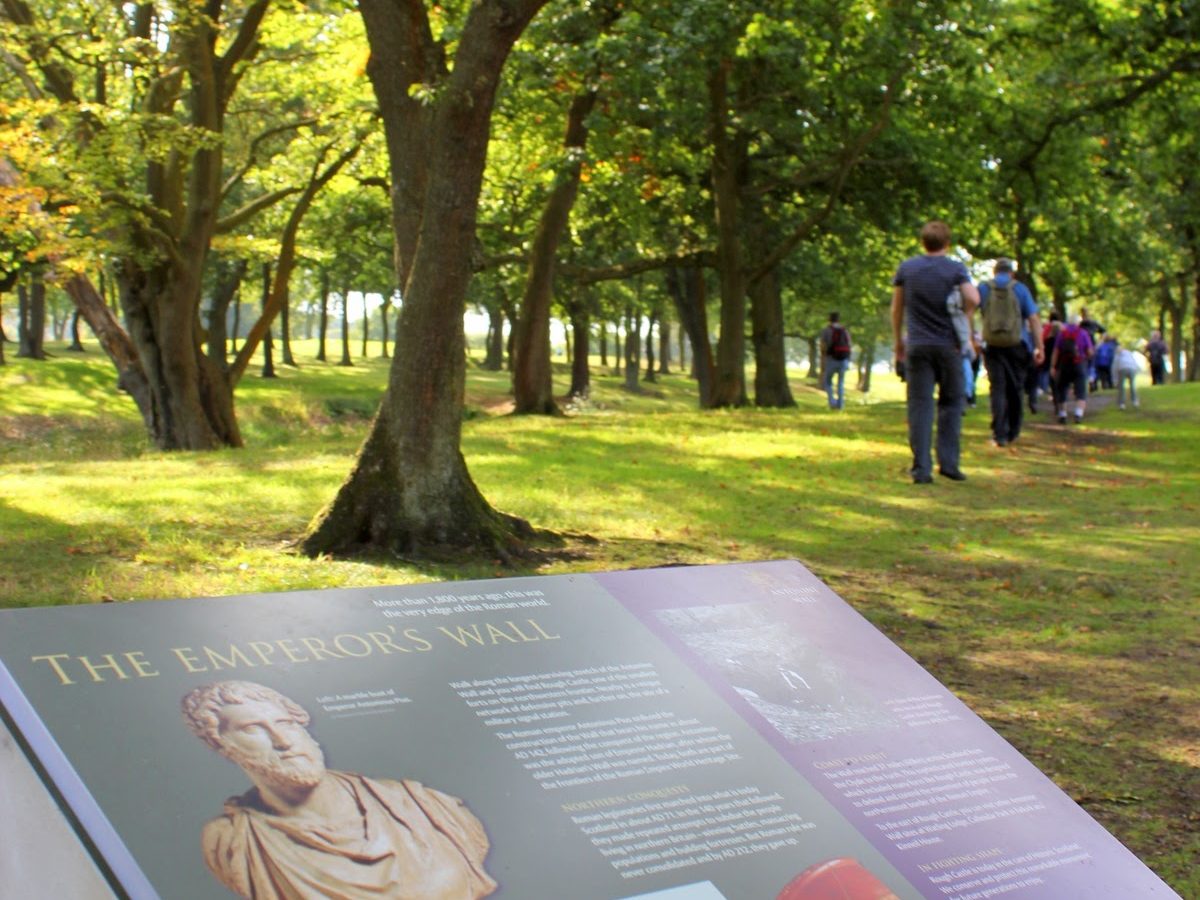
Walkers explore Rough Castle Roman Fort Site near Spoke ‘n’ Boot. Images: Adrian Mahoney.
Wall facts
Location: The Antonine Wall stretched across central Scotland, from the Firth of Forth (Bo’ness) to the Firth of Clyde (Old Kilpatrick).
Built by Romans: Construction began around AD 142 during the reign of Emperor Antoninus Pius.
Length: It ran for about 37 miles (60 km) and was shorter than Hadrian’s Wall (73 miles / 117 km).
Materials: Unlike Hadrian’s Wall (stone), the Antonine Wall was built mainly of turf blocks on a stone foundation, with a large ditch to the north and a road behind it for soldiers.
Forts: Around 16 forts and many smaller fortlets were built along the wall to house Roman troops.
Purpose: It was intended to mark the northern frontier of the Roman Empire in Britain and to control movement of people and goods.
Short use: The wall was only held for about 20 years before the Romans retreated back to Hadrian’s Wall around AD 162.
UNESCO World Heritage Site: Today, the Antonine Wall is part of the “Frontiers of the Roman Empire” World Heritage Site, alongside Hadrian’s Wall and the German Limes.
Distance slabs: Soldiers recorded their work with decorated distance slabs, unique to the Antonine Wall. Many of these can be seen in museums such as the Hunterian Museum in Glasgow.
Local legacy: Remains of the wall can still be seen in places like Rough Castle near Falkirk, at Callendar Park, Falkirk, and Kinneil Estate in Bo’ness.
Check out
- The Antonine Wall website
- Explore the Roman Antonine Wall (Bo’net)
- Discover the Antonine Wall (PDF, Falkirk Council)
- Antonine Wall and Forth and Clyde Canal (VisitLanarkshire)
- Antonine Wall Trail (John Muir Way)
- Antonine Wall Heritage Trail (West Dunbartonshire Council)
- Antonine Wall Community Map (West Dunbartonshire Council and partners)


You must be logged in to post a comment.